



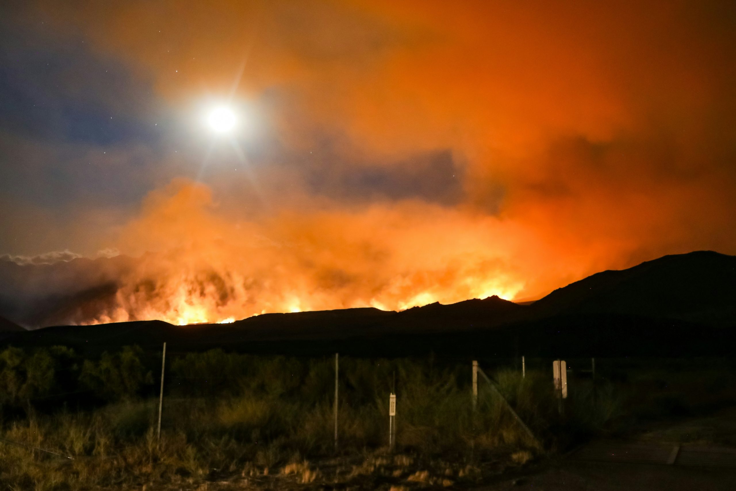
Lightning doesn’t ask for permission. It struck somewhere in Lincoln County, Nevada on the night of Friday, July 24, 2026, landed on land officially designated as withdrawn from public access, and started a fire. Within 24 hours it had burned 1,500 acres. Within three days it had crossed 2,000 acres. By the evening of Tuesday, July 28, the Bureau of Land Management reported the Quail Springs Fire had grown to 13,500 acres with zero percent containment.
The location makes this fire unlike most of the wildfire coverage that has dominated Nevada news throughout an already active 2026 fire season.
The Quail Springs Fire is burning within the Nevada Test and Training Range, the massive block of restricted federal land in southern Nevada that encompasses what the public knows as Area 51, officially the Air Force Flight Test Center Detachment 3, along with Nellis Air Force Base’s operational training ranges and other classified and restricted military installations. The land is closed to the public at all times, regardless of fire activity, regardless of any other circumstance. That closure predates this fire by decades and will remain in effect long after it’s contained.
The practical consequence is that the Quail Springs Fire is being fought on terrain most firefighters cannot access, using agencies most wildfire coverage never mentions, under conditions that combine everything that makes Nevada’s 2026 fire season exceptionally difficult: extreme heat, single-digit humidity, rough terrain, and the same relentless afternoon wind patterns that have driven every significant fire in the state this summer.
Who’s Actually Responding
The response to the Quail Springs Fire includes agencies not typically found on fire incident reports: the United States Air Force alongside the Bureau of Land Management and the Lincoln County Emergency Management Department.
That’s not a bureaucratic footnote. The Nevada Test and Training Range is active military land. The Air Force maintains operational and safety jurisdiction over that airspace and ground area that overlaps with and in some cases supersedes BLM land management authority. When a fire ignites within restricted military land, the chain of command for response, access decisions, and operational coordination reflects that dual jurisdiction in ways that civilian fires on standard BLM land don’t have to navigate.
It also means that the normal cadre of cooperating agencies, state forestry, county fire departments, neighboring tribe fire crews, doesn’t simply deploy to the fire perimeter the way they would for a blaze on accessible public land. Access to the NTTR requires clearances, coordination with military base operations, and compliance with security protocols that govern who can be present and where. Hotshot crews and air tanker pilots working the fire are operating within a security framework that shapes logistics in ways entirely invisible to public reporting.
The BLM’s initial response strategy reflected this constraint. Rather than full suppression, the agency initially deployed a confine-and-contain approach, using existing terrain features, natural barriers, and the fire’s expected behavior patterns to limit spread rather than directly attacking the fire’s perimeter. That strategy makes tactical sense for fires in extremely remote or inaccessible terrain, but it also accepts that the fire will burn more acreage than aggressive initial attack might have allowed. Given the restricted access and extreme fire behavior, it was the appropriate call.
The Growth Trajectory
The numbers tell a story of fire that doubled and then doubled again across days of unrelenting conditions.
Initial reports on July 24 put the fire at roughly 10 acres. By Saturday evening it had grown to 1,500 acres. Sunday afternoon computer-assisted estimates updated the figure to 2,000 acres. The fire then continued growing steadily through Monday and Tuesday, reaching the 13,500-acre mark as of the BLM’s evening update on July 28.
That growth rate, from 10 acres to 13,500 acres in four days, reflects exactly the conditions forecasters have been describing throughout Nevada’s 2026 fire season: fuels at historically dry levels after a warm winter that left mountain snowpack at 10 to 30 percent of normal, sustained afternoon winds that drive fire spread faster than crews can build containment lines, and overnight humidity recovery insufficient to slow fire behavior meaningfully between days.
The Quail Springs Fire is burning through pinyon and juniper timber as well as dry grass, a fuel combination that creates different fire behavior than the short grass and brush characteristic of some of the earlier 2026 Nevada fires. Pinyon-juniper systems produce denser smoke, can generate intense crown fire conditions when fully engaged, and tend to hold embers that create spotting risks ahead of the main fire line. The steep terrain within the NTTR compounds these fuel characteristics by channeling wind in ways that create unpredictable local fire behavior, accelerating uphill runs and making aerial operations less effective than they would be over flat or gently rolling landscape.
What Zero Percent Containment Actually Signals
Zero percent containment, maintained through four days and 13,500 acres of fire growth, means exactly what it sounds like: no established perimeter line is confirmed holding anywhere around the fire’s edge. Every section of the fire’s boundary is either actively burning outward or at risk of doing so.
The BLM’s frank assessment in its updates is useful to read directly. “Steep, rough terrain and extreme fire behavior are making direct suppression strategies difficult.” That sentence represents a professional acknowledgment that the conventional playbook for getting ahead of a fire isn’t working here, not because of any failure of effort or resources, but because the terrain and conditions are outside the range where conventional suppression reliably succeeds.
Fire behavior “active, with uphill runs and a significant increase in activity in the afternoon hours” describes conditions that experienced wildland firefighters recognize as the most challenging combination: terrain-driven fire acceleration on uphill slopes during the afternoon heating window, when wind, temperature, and humidity reach their daily worst simultaneously. Crews can make gains in the morning. By early afternoon those gains can evaporate as the day’s heat pushes fire behavior back to active spread.
As of the most recent BLM update, conditions in the northern portion of the fire’s projected path were expected to offer better terrain for engagement, with forecasters noting that as the fire moves north, terrain conditions should improve and give crews more opportunities to engage directly. That’s a measured optimism that suggests containment progress may become possible once the fire reaches ground where equipment can operate and lines can hold.
Highway 375 and the Rachel Question
No evacuations have been ordered in connection with the Quail Springs Fire. The BLM has been consistent on this point across every update. No publicly accessible structures are threatened. No residences are in the fire’s current path.
But the BLM’s mention of Highway 375 in its contingency planning is worth noting. Highway 375 is the two-lane state road that runs through the heart of Lincoln County, designated by Nevada as the “Extraterrestrial Highway” because of its proximity to the NTTR and the tourist curiosity the area generates. The small unincorporated community of Rachel, population a few dozen permanent residents, sits directly on Highway 375 about two hours north of Las Vegas.
BLM officials said Highway 375 may be impacted by smoke depending on fire behavior, and that if contingency plans are activated, the highway may experience temporary closures, though no closures are currently planned. The nearby town of Rachel might be getting some smoke, the agency noted, but is not threatened by the fire itself, which is progressing primarily to the north.
That distinction matters: smoke and fire are different concerns, and Rachel’s situation currently involves the former rather than the latter. But the contingency language signals that fire managers are keeping the highway corridor within their planning envelope, not because immediate threat exists, but because responsible incident management accounts for scenarios where active fire behavior changes the picture.
Nevada’s 2026 Fire Season in Context
The Quail Springs Fire is the third significant Lincoln County wildfire of the 2026 season, following the Kane Springs and Grapevine fires that burned a combined 41,000-plus acres through late June and into July. Its appearance within weeks of those fires, in the same county, driven by the same climate conditions, is not coincidental.
Nevada’s fire danger tracker and federal forecasters noted early in the season that fuels across the Great Basin were nearing record dry levels after the deficient snowpack winter, with fire season arriving four to six weeks ahead of the historical schedule. That early-season warning has now materialized into an extended sequence of significant fire events across a region that, while sparsely populated, contains critical federal land, watershed, military, and recreational resources that represent real stakes beyond simple acreage numbers.
The current extreme heat event layered on top of this fire season creates conditions where fire growth rates, already elevated by record dry fuels and persistent wind, become even more extreme. Every degree above normal reduces the fuel moisture that provides even minimal resistance to ignition and spread. At 117 degrees, with humidity in the single digits and afternoon winds pushing through Lincoln County, the environment offers fire essentially no natural brakes.
Approximately one-third of national firefighting resources were already deployed to the Great Basin region earlier in the season. As the Quail Springs Fire grows and the extreme heat warning pushes conditions to some of the most dangerous of the year, those resource allocation questions become more pressing. Fire season traditionally peaks in July and August, and Nevada has already been burning since June.
The Restricted Land Dimension
There’s a dimension of the Quail Springs Fire that civilian wildfire coverage understandably handles carefully: the military land context. The Nevada Test and Training Range isn’t just any federal land. It’s one of the most sensitive restricted military areas in the United States, encompassing classified testing and training operations that have been ongoing for decades.
That doesn’t mean the fire creates any security crisis or unusual military risk. Wildfires on military land are handled as they are anywhere else, with appropriate interagency coordination and resource deployment. But it does mean that the kind of on-the-ground reporting, embedded journalists, public observation of aerial operations, visitor-facing information about firefighter deployments that characterizes coverage of major civilian wildfires simply doesn’t apply here.
What the public knows about the Quail Springs Fire is what BLM public affairs releases and official incident reports provide. What happens within the NTTR’s restricted airspace and ground operations remains, appropriately, outside the public information window.
For Las Vegas, which sits roughly 100 miles south of the fire, the primary impact is the smoke that Ella Mountain fire cameras have already captured drifting across Lincoln County’s skies. Air quality monitoring in Clark County has been tracking the fire’s smoke contribution along with smoke from other active regional fires, with current readings staying in acceptable ranges but with the caveat that wind-driven smoke behavior can shift quickly.
The Quail Springs Fire will eventually be contained. Every fire is. The question heading into the hottest weekend of 2026 is how many more acres it claims before conditions allow firefighters to get ahead of it.
Key Insights
The dual jurisdiction structure of the Nevada Test and Training Range, requiring U.S. Air Force coordination alongside BLM for fire response, creates access and logistics constraints that distinguish the Quail Springs Fire from civilian wildland fires and limit the conventional cooperative agency response that typically accelerates containment progress.
Zero percent containment across 13,500 acres after four days of active burning reflects the combined effect of steep inaccessible terrain, pinyon-juniper fuel types that produce intense crown fire conditions, and persistent afternoon wind events that reverse overnight suppression gains during the daily peak heat window.
The fire’s growth arc from 10 acres to 13,500 acres in four days, occurring during the same week Las Vegas is tracking toward a potential 117-degree record, illustrates how the extreme heat event and active wildfire season are not separate phenomena but different manifestations of the same regional climate and weather pattern.
Lincoln County’s third significant wildfire of the 2026 season arriving within weeks of the Kane Springs and Grapevine fires, which burned over 41,000 combined acres through June and July, signals that Nevada’s fire season arrived ahead of schedule and has sustained activity well beyond typical early-season patterns.
Sources
Las Vegas Review-Journal Quail Springs Coverage
FOX5 Vegas Fire Report
News3 Las Vegas Fire Update
BLM Nevada Incident Update
8 News Now Area 51 Fire Report